


Transforming spatial data into operational decisions
UrbiVerde aspire to operationalize Earth Observation (EO) services to address climate change challenges and strengthen urban resilience.
The project aims to bridge the “last mile” between spatial data and end users by producing information that can be directly used for decision-making.
The “Information Factory” platform provides cloud-based services, integrating EO and non-EO data, to generate actionable insights for stakeholder decision-making.

Capabilities serving urban resilience
The UrbiVerde project supports local authorities at every stage, from observation to decision-making, by combining satellite data, domain expertise, and operational tools. Its focus is on climate change adaptation, with a particular emphasis on urban resilience. The project is built around concrete use cases developed in close collaboration with local stakeholders to address real-world operational needs.

Adapt & anticipate
Understand climate changes and anticipate their impacts on territories.

Support decision-making
Help local authorities address concrete issues and guide their actions.

Deploy efficiently
Rely on proven components to ensure reliable, fast and controlled deployment.

Measure & analyze
Produce reliable indicators tailored to local needs using observation data.

Access data easily
Deploy an intuitive cloud platform for autonomous, fast and secure use of indicators.

Co-develop with territories
Develop solutions in collaboration with local stakeholders and mobilize an ecosystem of experts.
An accessible cloud platform
The project designs, develops, and deploys an easily accessible cloud platform. It aims to bridge the gap between end users and service providers within an environment that is user-friendly, adaptable, and secure.
From experimentation to a sustainable operational solution
The UrbiVerde project relies on existing EO cloud infrastructures to develop user-driven services, moving from demonstrator to operational and scalable implementation.
A consortium with complementary expertise
The consortium integrates EO data, in-situ urban infrastructure indicators and socio-economic data to produce enriched and actionable insights supporting resilience planning, risk assessment and public policy implementation.
The Cerema ensures active involvement of public authorities and urban stakeholders, guaranteeing operational relevance and strong alignment with resilience frameworks at local, national and European levels.
Thanks to Aerospace Valley’s innovation ecosystem and CS GROUP’s industrial solutions, the services are designed to evolve from pilot demonstrations to sustainable operational offerings across France and Europe.
The UrbiVerde project is therefore built on a consortium of highly experienced partners, working in collaboration with pilot territories facing a diverse range of operational challenges.

CS GROUP
CS GROUP is a mid-sized European company with an entrepreneurial, agile, and innovative culture, backed by a high level of technical and professional expertise. It is a trusted partner to leading French and international organizations in the digital transformation of operational systems across several key economic sectors, including space, defense and security, aerospace, and energy. CS GROUP is highly active in the field of Earth observation, with numerous projects for the European Space Agency (ESA) and the French Space Agency (CNES).
CS GROUP designs, develops, deploys, maintains, and operates intelligent, secure, and interconnected systems. Based on innovative solutions and products, these systems ensure the efficiency and security of its customers’ operations and critical missions, which are subject to extremely demanding requirements. CS GROUP and its 2,800 employees in France and abroad are committed to anticipating and shaping the future by supporting the success of their customers’ strategic projects today. Innovation, a core part of the company’s culture, is at the heart of its technical and professional approach.
With its own subsidiaries in Europe, Asia, and North America, CS GROUP retains its independence and governance, with its headquarters in Le Plessis-Robinson, France. CS GROUP is now part of the Sopra Steria Group, benefiting from the assets, resources, and investment capabilities of a 50,000-strong European technology leader offering a comprehensive, end-to-end approach to successful digital transformation.
CS GROUP brings strong expertise to the UrbiVerde project in systems integration, secure data processing, and critical software, ensuring the reliability and scalability of Earth observation-based services.

Murmuration
Murmuration is a French mid-sized company (ETI) founded in March 2019 with the aim of integrating environmental considerations into every decision-making process. Initially supported by the European Space Agency (ESA) through its Business Incubation Centre (ESA BIC) programme and drawing on extensive and long-standing expertise in the space sector, the company uses satellite Earth observation (EO), notably through the Copernicus programme, to achieve this goal. Since March 2019, the team has grown from two founders to 20 full-time employees, developing activities focused on extracting information from EO data and making it accessible to a broad audience—from institutions and businesses to the general public.
Murmuration has developed a unique ability to extract more than 25 environmental indicators covering five main areas: land monitoring, water quality, air quality, biodiversity, and the characterization of anthropogenic pressures.
These indicators combine data from Copernicus services and Sentinel satellites (including CAMS, CLMS, CMEMS, C3S, Sentinel-1, and Sentinel-2), as well as other sources such as weather and mobile phone data, to quantify environmental conditions anywhere in the world. These developments are progressively being put into operation, notably through DIAS platforms and Destination Earth (DestinE), making information extraction systematic and up to date in line with users’ needs.
Murmuration develops environmental monitoring dashboards for decision-makers and local authorities, helping them make informed decisions and better integrate environmental conditions into the management of their territories. The company is a trusted partner and service provider in France and internationally, with direct contracts with major organizations such as the European Space Agency (ESA), the European Commission, the European Bank for Reconstruction and Development (EBRD), VINCI Concessions, the ACCOR Group, the Malta Tourism Authority (MTA), and various local tourism authorities across Europe. Murmuration also has a long-standing partnership with CNES, the French Space Agency, which provides valuable support in terms of expertise and innovation.
Murmuration contributes to the UrbiVerde project by providing advanced, AI-driven geospatial intelligence based on EO data, enabling precise monitoring of the environment and urban areas.
The Cerema
The Cerema (Centre for Studies and Expertise on Risks, the Environment, Mobility and Land Planning) is France’s leading public institution dedicated to developing and promoting public-sector expertise in land-use planning, territorial cohesion, and the ecological and energy transition. It has unique expertise in mobility, transport infrastructure, urban planning and construction, resource conservation, risk prevention, road and maritime safety, as well as the ability to integrate these different areas of expertise into territorial project design.
As a multidisciplinary centre for scientific and technical resources, the Cerema supports the design, implementation, and evaluation of public policies at both national and local levels. It also provides direct support to public services, local authorities, and businesses through project management assistance, specific operational assignments, and other forms of technical support. The Cerema designs, tests, and disseminates innovative solutions.
With more than 2,500 employees across metropolitan France and overseas territories, and in-depth knowledge of local challenges, the Cerema is firmly committed to the challenge of sustainable territorial development, helping shape the public policies of tomorrow.
Since 2023, local authorities have been able to become members of the Cerema, strengthening their collaborative partnerships. Several member cities with which the Cerema maintains close relationships will participate in the project to better understand and address cities’ expectations and needs regarding decision-support tools for urban resilience.
The Cerema contributes to the UrbiVerde project with its public-sector expertise in sustainable urban development and climate change adaptation. It provides in-depth operational knowledge, direct access to end users’ needs, and strong alignment with public policy objectives.

Aerospace Valley
Aerospace Valley is Europe’s leading competitiveness cluster dedicated to the aerospace, space, and drone sectors, covering the Occitanie and Nouvelle-Aquitaine regions. It represents more than 150,000 workers, 13,000 students, and 8,500 researchers, accounting for over 40% of France’s aerospace workforce.
Since 2005, its mission has been to support innovation, accelerate digital transformation, foster the ecological transition, and strengthen the competitiveness of its 866 members, including major companies, SMEs, startups, research laboratories, academic institutions, and public organizations. The cluster is structured around:
- 3 strategic sectors (S2): Aerospace, Space, and Drones.
- 5 ecosystems of excellence (E2): covering cross-cutting technologies such as artificial intelligence, propulsion, materials, and intelligent systems.
Aerospace Valley plays a key role in climate-related space initiatives, coordinating and participating in European projects (SCALE, Space4Cities, PCP-WISE) that use satellite data for environmental monitoring and addressing urban challenges.
It also supports startups and SMEs through programmes such as ESA BIC Sud de France and DISTRICT, fostering the development of innovative space-based solutions.
Finally, Aerospace Valley acts as a catalyst for the regional and national space ecosystem, connecting industry, academia, and public institutions, while contributing to the development of strategic roadmaps for the future of space applications.
Aerospace Valley has recognized expertise in content creation and dissemination, as well as community management, demonstrated through the communication tools it has successfully implemented to promote its organization and members (website, collaborative platform, social media, digital directory, newsletters, etc.). It has an integrated communications and events department comprising an experienced and creative team capable of defining editorial strategies, producing high-quality content across all media, and effectively engaging stakeholders within its ecosystem. This division brings together 360° communications experts (print and digital) with proven experience in managing communications projects—from needs analysis through to implementation and monitoring—and successfully delivers the full range of its activities.
Within the UrbiVerde project, Aerospace Valley leverages its position as a leading European innovation cluster to foster ecosystem collaboration, facilitate market access, and support scaling.
Pilot territories using UrbiVerde to better understand, anticipate and act on climate challenges.
Diverse territories, representative of climate challenges. UrbiVerde is co-developed and tested with several pilot cities to demonstrate the value of its data in real-world contexts.
Nancy
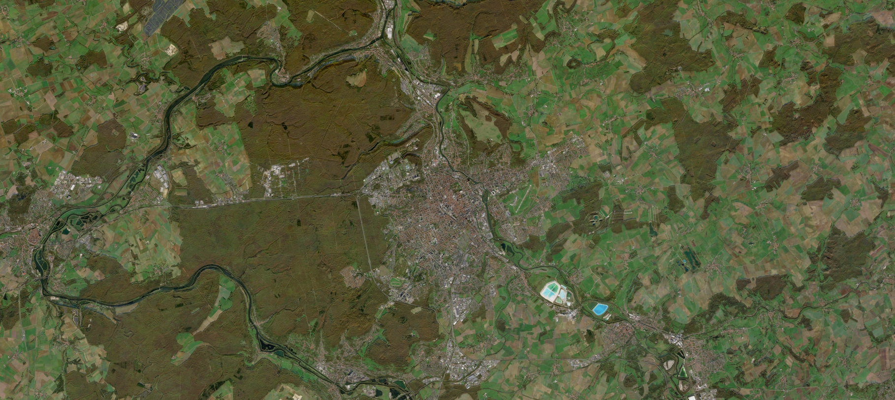
Located in the Grand Est region of France, the city of Nancy faces a range of climate-related challenges due to its semi-continental climate and dense urban fabric. Heavy rainfall events, flood risks, and heatwaves require a better understanding of local dynamics.
In this context, UrbiVerde supports the local authority in analyzing and monitoring key indicators, strengthening its ability to anticipate extreme weather events and adapt its urban planning strategies.
La Roche-sur-Yon
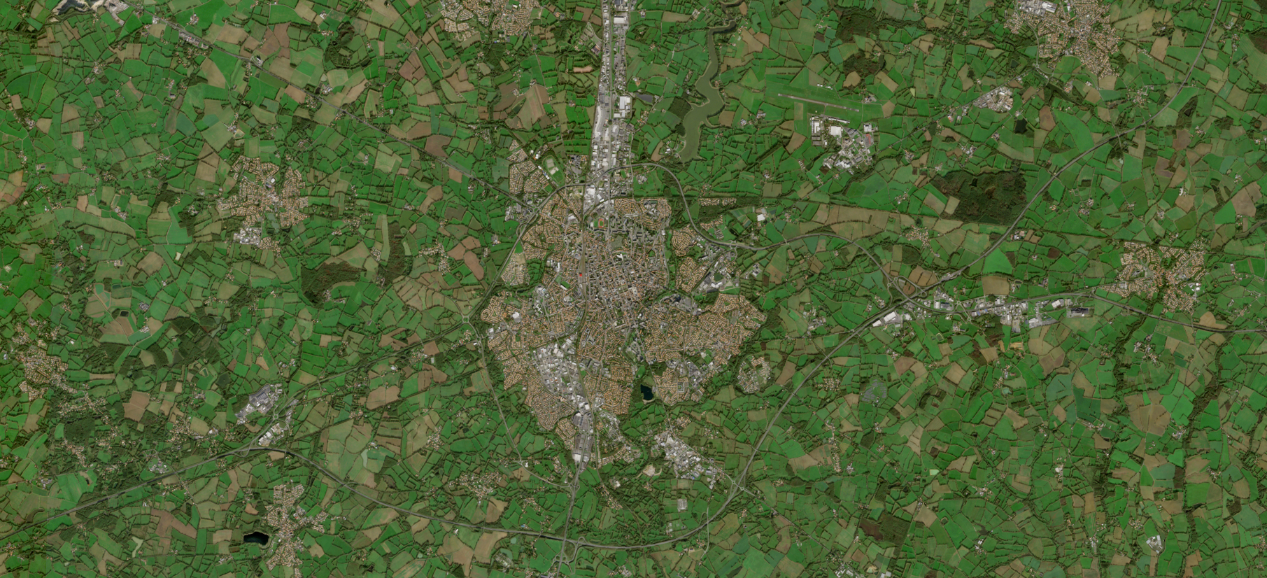
Located in the Pays de la Loire region of France, La Roche-sur-Yon operates in an oceanic climate characterized by significant variability, as well as episodes of flooding and urban heat. These challenges require a better understanding of local dynamics to adapt urban development and strengthen the territory’s resilience.
In this context, UrbiVerde supports the local authority by providing precise indicators to monitor changes in urban phenomena and optimize urban planning strategies.
Perpignan
Kourou
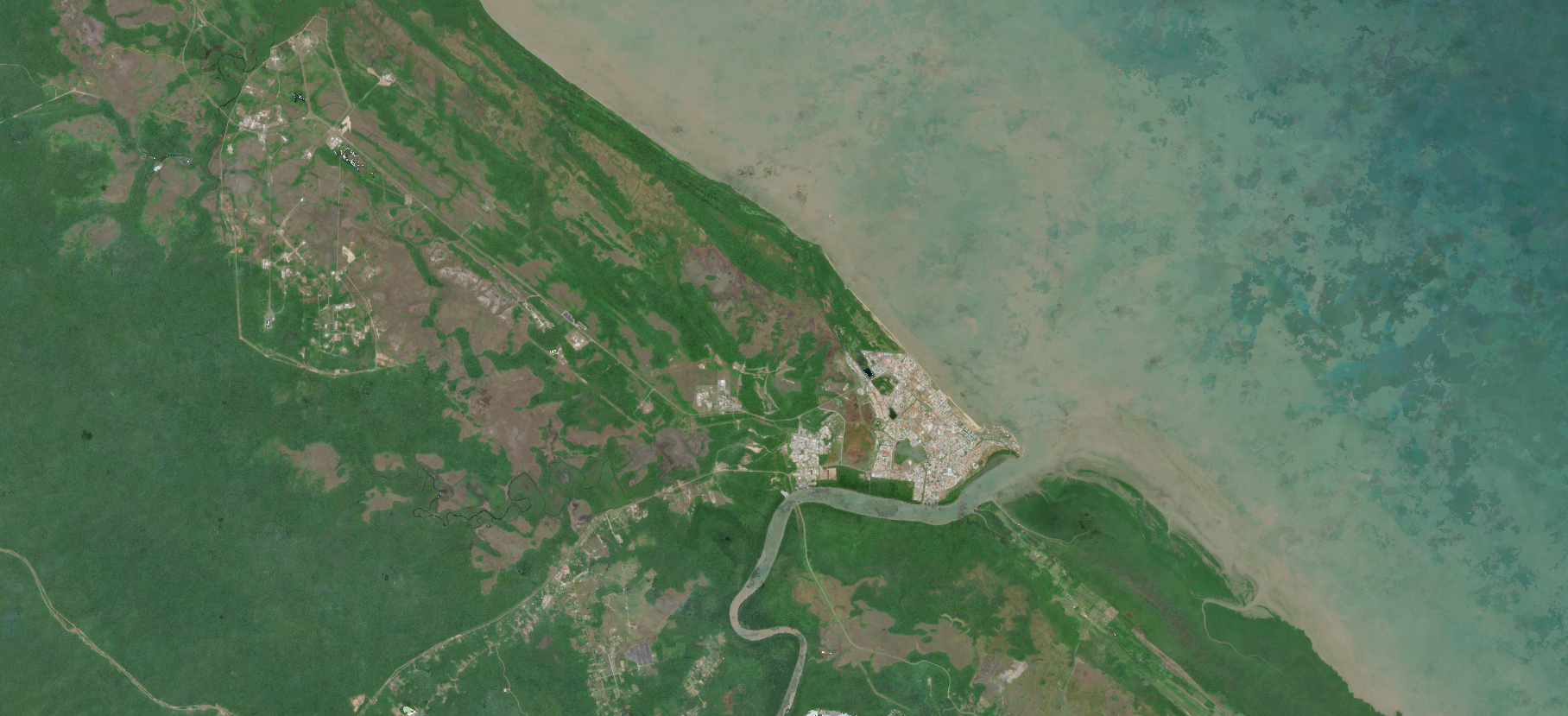
Located in French Guiana, Kourou is situated in a tropical environment characterized by rich biodiversity and sensitive ecosystems. This context creates specific challenges related to the preservation of natural habitats and the management of environmental pressures.
In this context, UrbiVerde supports the local authority by providing reliable indicators to better understand ecological dynamics and inform appropriate decision-making, balancing development with ecosystem preservation.