Advanced environmental analysis services
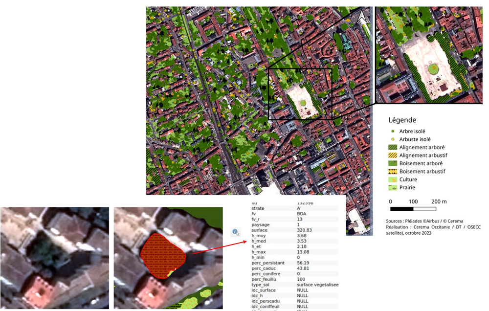
The services provided enable the detection of vegetation in urban environments, the identification of their structure (shrub, tree, or herbaceous), as well as their organization (isolated, aligned, or wooded).
They also provide detailed indicators to characterize vegetation: type (evergreen or deciduous, coniferous or broadleaf), heights (minimum, average, maximum), and surface coverage.
These analyses help better understand urban dynamics and support decision-making tools for planning and territorial resilience.
Mapping and analyzing urban vegetation
Detect vegetation, its layer (shrub, tree, or herbaceous), and its form (isolated, aligned, or wooded)
Vegetation mapping
Determine characteristics of detected vegetation
Percentage of evergreen/deciduous, coniferous/broadleaf
Heights (min, avg, max) and surface coverage
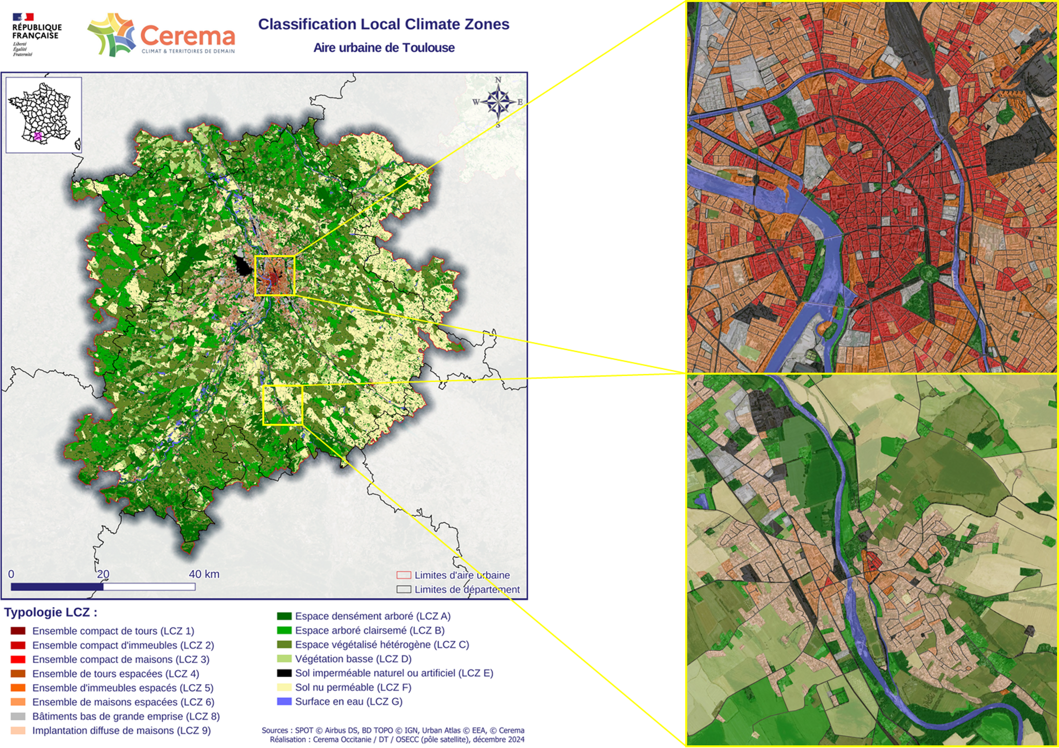
Local Climate Zone (LCZ) Service
Identifies urban areas more sensitive to the urban heat island effect
Based on morphological and land-use data
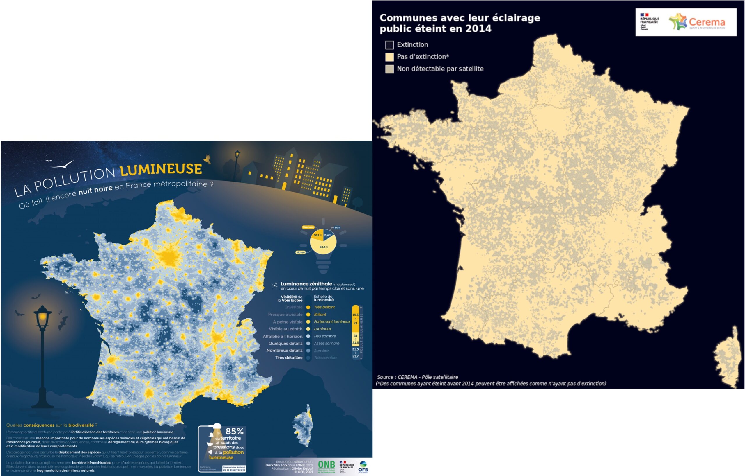
Light pollution:
Identify public lighting shutdowns
Determine the proportion of territory highly impacted by light pollution and its intensity
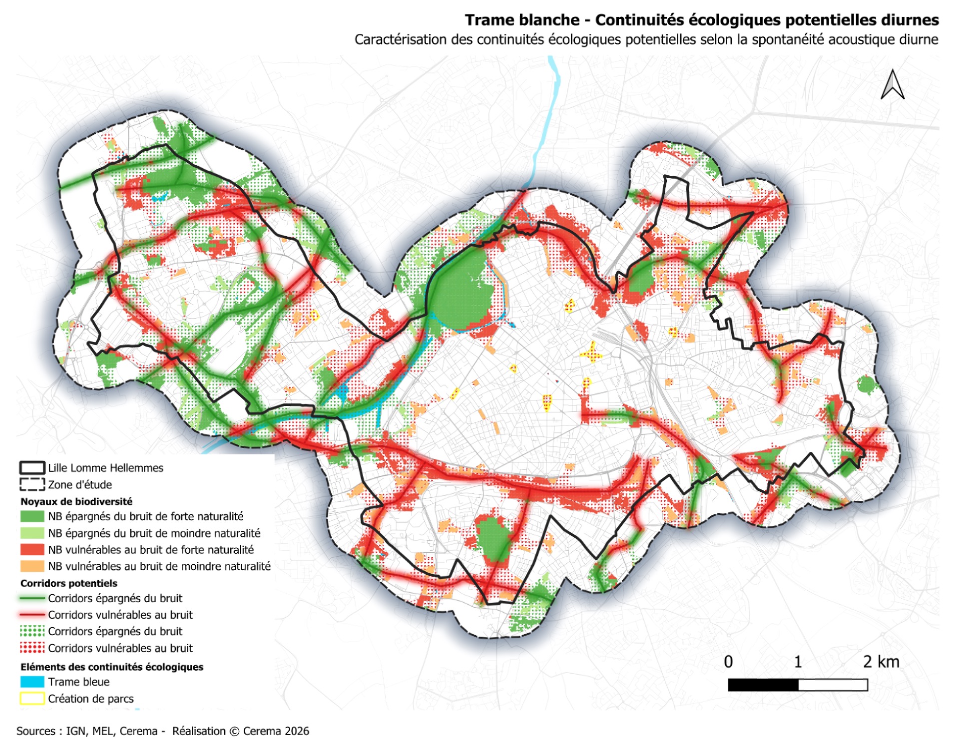
Noise pollution:
Identify urban ecological corridors
Model acoustic dynamics to detect noise pollution
Highlight ecological continuities vulnerable to noise